
想了解澳洲悉尼北岸?看这篇文章就够了
来源:Realtisan 作者:Aries
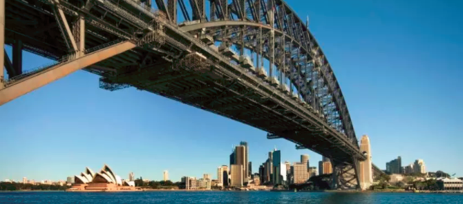 Sydney Harbor Bridge
跨过悉尼的标志性建筑之一,悉尼海港大桥,就是我们说的悉尼北岸(North Shore)。悉尼北岸通常指位于悉尼港北部的郊区,包括Hornsby以及Middle Harbour和Lane Cove River之间的地区。北岸又分为下北岸(Lower North Shore)和上北岸(Upper North Shore).
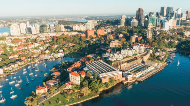
下北岸 Lower North Shore
上北岸 Upper North Shore
North Sydney Council
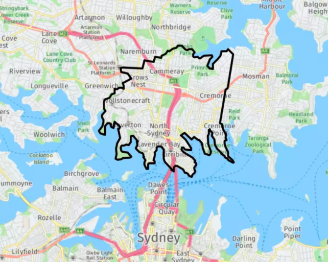 North Sydney Council主要是一个住宅区,但也有大量的商业区,区域内有超过三分之二的中等密度住宅。
行政区域内的Milson's point连接着悉尼海港大桥,也是一个拥有无敌景观的区域。人气公园Luna Park也位于Milson's Point。
截至2016年人口普查,North Sydney Council市政府估计人口为67,658。
● Cammeray
● Cremorne
● Cremorne Point
● Crows Nest
● Kirribilli
● Kurraba Point
● Lavender Bay
● McMahons Point
● Milsons Point
● Neutral Bay
● North Sydney
● St Leonards
● Waverton
● Wollstonecraft
City of Willoughby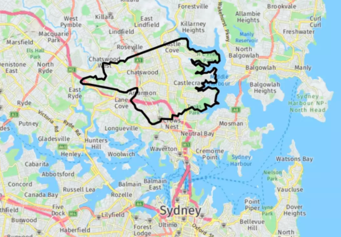
在City of Willoughby内的St Leonards,皇家北岸医院(Royal North Shore Hospitals)是悉尼的主要医院之一。
截至2016年人口普查,City of Willoughby市政府估计人口为74,302。
● Artarmon
● Castle Cove
● Castlecrag
● Chatswood
● Chatswood West (shared with City of Ryde)
● Naremburn
● North Willoughby
● Northbridge
● Roseville (shared with Ku-ring-gai Council)
● St Leonards (shared with Municipality of Lane Coveand North Sydney Council)
● Willoughby
Ku-ring-gai Council
同样位于上北岸的Ku-ring-gai Council地区以曾经居住在该地区的Kuringgai部落命名。
Ku-ring-gai是澳大利亚最具优势的居住区,位于全澳洲相对社会经济优势和劣势指数(IRSAD)的顶端。
Ku-ring-gai议会地区的人口年龄中位数为41岁; 略高于全国38岁的中位数。
在2016年人口普查中,该地区语言多样化,超过18%的家庭使用亚洲语言; 是全国平均水平的四倍多
● East Killara
● East Lindfield
● Gordon
● Killara
● Lindfield
● North Turramurra
● North Wahroonga
● Pymble
● Roseville (Shared with Willoughby)
● South Turramurra
● St Ives
● St Ives Chase
● Turramurra
● Wahroonga (Shared with Hornsby)
● Warrawee
● West Pymble
Hornsby Shire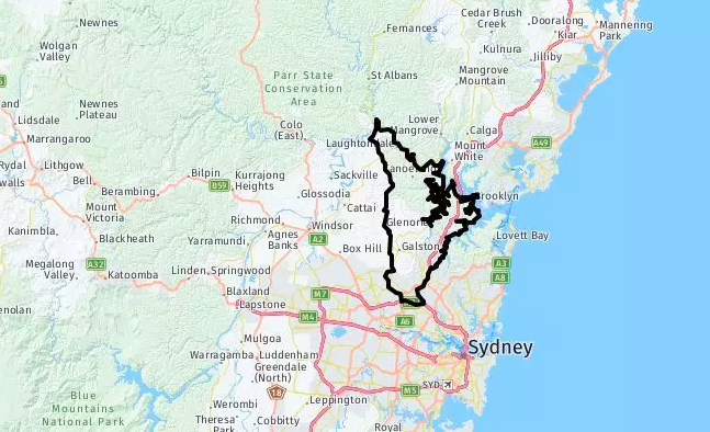
● Asquith
● Beecroft (shared with City of Parramatta Council)
● Berowra
● Berowra Heights
● Berowra Waters
● Brooklyn
● Castle Hill (shared with The Hills Shire)
● Cheltenham
● Cherrybrook
● Cowan
● Hornsby
● Hornsby Heights
● Mount Colah
● Mount Ku-ring-gai
● Normanhurst
● North Epping
● Pennant Hills
● Thornleigh
● Wahroonga (shared with Ku-ring-gai Council)
● Waitara
● Westleigh
● West Pennant Hills (shared with The Hills Shire)
Lane Cove Council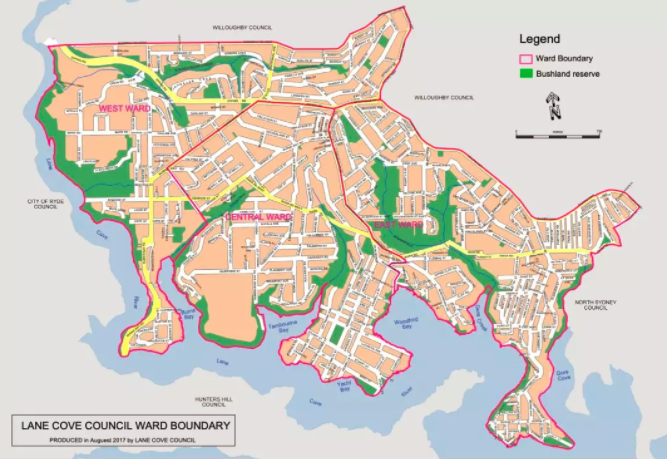
● Greenwich
● Lane Cove
● Lane Cove North (shared with Willoughby)
● Lane Cove West
● Linley Point
● Longueville
● Northwood
● Riverview
● St Leonards (shared with Willoughby and North Sydney)
Municipality of Hunter's Hill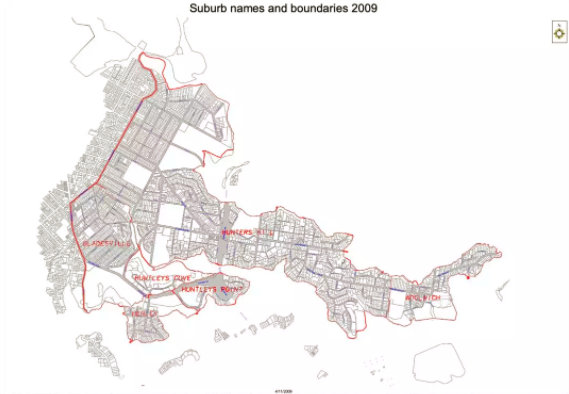
Municipality of Hunter's Hill的行政区域面积为5.7平方公里(2.2平方英里),按地区划分,是新南威尔士州最小的地方政府区域,自1861年宣布以来,其边界基本保持不变。
截至2016年人口普查,市政府估计人口为13,199。
Gladesville (parts are located within the City of Ryde)
● Henley
● Hunters Hill
● Huntleys Cove
● Huntleys Point
● Woolwich
Mosman Council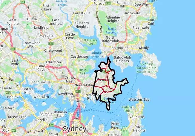
说起Mosman,有一个这样的问题:“请问悉尼的动物园在哪里?”“在Mosman,全悉尼下北区房价最贵的区域,抻不抻脖子那都是一线水景。”
有着无敌水景的Mosman是悉尼著名的顶级富人区之一。居住在Mosman的人口面貌除了医生,律师等,还有很多澳洲名流,当地人的平均家庭收入在17万澳币以上,是悉尼平均收入的近3倍。
在2016年人口普查中,Mosman Council当地政府区有28,475人。
Mosman Council地区的人口年龄中位数为42岁; 显着高于38年的全国平均水平。
0-14岁的儿童占人口的17.6%,65岁及以上的人口占人口的19.1%。
地区在15岁及以上的人口中,51.8%的人已婚,10.3%的人离婚或分居。
根据2016年人口普查数据,在Mosman地区,有44.5%的高收入家庭,每周家庭收入超过2,500澳元。Mosman Council地区的家庭收入中位数是$2,522,显著高于全国平均水平,区域内每周家庭收入$6,000 – 7,999澳元的家庭比例高达9.5%,相比较,大悉尼区域这一比例仅2.5%。
Mosman Council区域内Suburb包括:
● Balmoral
● Beauty Point
● Middle Harbor
● Middle Head
● Mosman Bay
● Mosman Central
● Mosman Junction